Complete Route Map
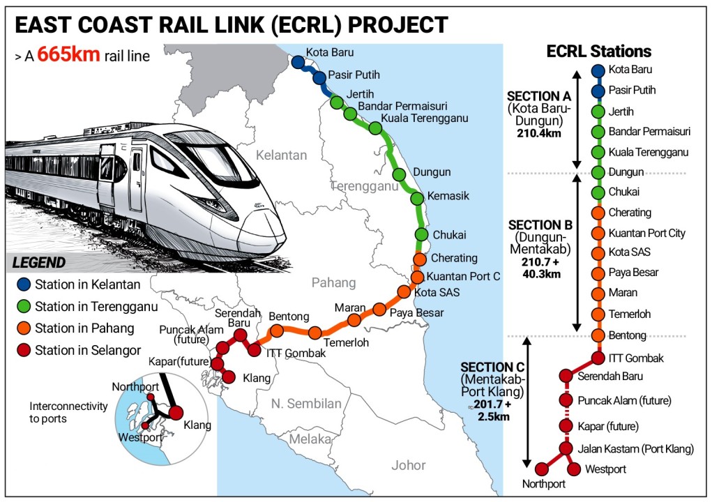
The ECRL route spans 665km across Kelantan, Terengganu, Pahang, and Selangor
665 kilometers connecting Malaysia's East and West Coasts
The ECRL route spans 665km across Kelantan, Terengganu, Pahang, and Selangor
The ECRL begins in Kota Bharu, Kelantan, which is planned as a major transportation hub in the northeast. From there, the alignment proceeds southwest through Pasir Puteh, offering improved access to southern Kelantan.
The route then enters Terengganu, passing through key towns along the state's coastline. Major stations here include Jerteh, Bandar Permaisuri, Kuala Terengganu (the state capital), Dungun, Kemasik, and Chukai.
Continuing south, the rail enters Pahang, moving through Cherating, Kuantan Port City, Kota SAS, Paya Besar, Maran, Temerloh, and Bentong. The ECRL traverses the Titiwangsa mountain range through engineered tunnels and viaducts.
The line eventually arrives at the Gombak Integrated Terminal in Selangor. Phase 2 continues from Gombak to Port Klang, passing through Serendah, Puncak Alam, and Kapar.
665 kilometers from Kota Bharu to Port Klang
4 hours from Gombak to Kota Bharu (express)
160 km/h for passenger trains
Traverses Titiwangsa range via tunnels and viaducts